An oil slick has been detected in the Indian Ocean search area for the missing Malaysia Airlines plane as hopes of picking up more acoustic signals from its black box are abandoned.
Joint Agency Co-ordination Centre chief Angus Houston said on Monday the Australian Defence Force vessel Ocean Shield had ceased searching for more acoustic signals with its towed pinger locator.
But an automated underwater vehicle would be deployed on Monday evening to conduct sonar searches for wreckage.
Retired Air Chief Marshal Houston said no acoustic pings had been detected since Tuesday last week and it was now time for the next step in the search.
He said it was extremely unlikely on day 38 of the search that there was any power left in the flight data and cockpit voice recorder batteries.
They have a maximum life of 40 days while the manufacturer says the shelf life is 30 days.
“We haven’t had a single detection in six days,” Mr Houston told reporters in Perth, which is some 2200km from the search area.
“It’s time to go underwater.”
Mr Houston said a two litre sample had been taken of the oil slick, which was seen about 5500 metres downwind and downsea from where two pairs of acoustic signals were detected last week.
The sample will be tested when it arrives ashore. That will take several days.
“I stress the source of the oil is yet to be determined,” Air Chief Marshal Houston said.
The oil slick, combined with the four pings picked up on April 5 and April 8, represent the most promising lead in the search so far, he said.
“We need to pursue this lead as far as possible.”
Analysis of the signals had allowed a reduced and manageable search area to be defined, he said.
Mr Houston reiterated that the location of the missing plane could not be confirmed until there had been a visual sighting of the wreckage, with the autonomous underwater vehicle Bluefin 21 equipped to take images.
Each underwater mission will take 24 hours to complete, including the downloading of data. And there would be no indication of whether the vehicle had encountered anything until that data had been viewed, he said.
Mission number one – commencing on Monday evening – will cover an area of 40 square kilometres.
Mr Houston said the robotic vessel could not go any deeper than 4500 metres, which is the estimated depth in the search area.
If the water is found to be deeper, with the sidescan sonar producing a high resolution map of the sea floor, another much larger vessel with wreckage recovery capability will be deployed.
Mr Houston said that was “being looked at as we speak”.
Little was known about the underwater terrain, but it was rolling and not sharply mountainous, he said.
“This is an area which is new to man,” he said.
What is known is that silt is thick in the area, which could complicate the search.
He said it was important to be realistic about the prospects of finding anything.
“It may be very difficult. This will be a slow and painstaking process.”
Mr Houston also said an acoustic signal picked up by the Chinese vessel Haixun-01 on April 5 had been “discounted as a credible transmission”.
By Rebecca Le May
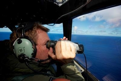
IMAGE: Co Pilot Sqn Ldr Brent McKenzie of a Royal New Zealand Air Force P-3 Orion taking part in the search trying to locate missing Malaysia Airways Flight MH370 over the Indian Ocean. (AAP Image/Richard Wainwright)


